Red Grid MGRS
V3.3.0 — LatestFree 10-digit MGRS for everyone. Offline maps, topographic tiles, Meshtastic mesh networking, 10 tactical tools. Zero network dependency.
Replace a $2,500 Military Device
AN/PSN-13 DAGR
$2,500+
Military GPS Receiver
Restricted distribution
Red Grid MGRS
Free
Your iPhone
Available to everyone
Shared Capabilities
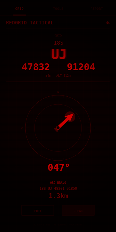
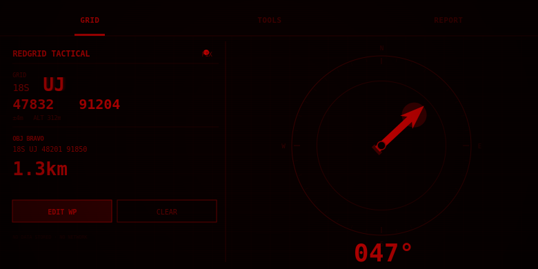
- ✓ Live MGRS coordinates (4/6/8/10-digit)
- ✓ Waypoint storage with bearing/distance
- ✓ Magnetic declination (WMM)
- ✓ Multiple coordinate formats
- ✓ Full offline operation
What Red Grid MGRS Adds
- + 10 tactical tools
- + 6 radio-ready report templates
- + Offline tactical maps with tile download
- + Meshtastic mesh networking
- + NATO voice readout
- + External GPS, GPX/KML, mission planning
What Red Grid MGRS Does
Offline Tactical Maps
Download tiles for your AO. Three map styles: standard, dark tactical, and topographic with contour lines. Toggle offline mode for zero-network map use.
Meshtastic Mesh
Share your grid position over LoRa mesh via BLE. See other mesh users' coordinates, bearing, and distance. No cell service, no internet needed.
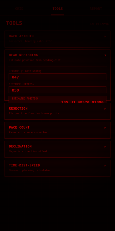
10 Tactical Tools
Back azimuth, dead reckoning, two-point resection, pace count, declination, TDS, sun/moon, precision selector, elevation/slope, photo geostamp.
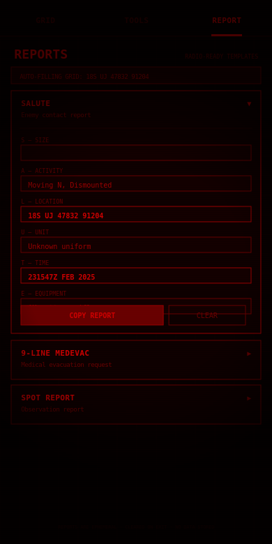
6 Report Templates
SALUTE, 9-Line MEDEVAC, SPOT report, ICS 201 briefing, CASEVAC request, CFF fire mission. Pre-formatted for radio transmission.
NATO Voice Readout
Proper phonetic pronunciation of grid coordinates. Shake to speak. Hands-free grid calls with correct NATO digit pronunciation.
External GPS
Garmin GLO, Bad Elf, and other BLE GPS receivers for enhanced accuracy beyond your phone's built-in GPS.
Mission Planning
Route overlay on map with leg distances and nearest-neighbor optimization. GPX/KML import via document picker, export via Share sheet.
Photo Geostamp
Burns MGRS coordinates and date-time-group onto photos. Tactical documentation without modifying camera roll originals.
4 Tactical Themes
Red Lens (night vision preservation), NVG Green (NOD compatible), Day White (high-contrast daylight), Blue Force (tactical blue). OLED true black.
Who It's For
Military & Law Enforcement
Land navigation training, patrol reporting, call for fire, MEDEVAC requests. Offline maps and Meshtastic mesh for zero-infrastructure environments.
SAR & First Responders
Backcountry navigation with military-grade precision. Waypoints, bearing/distance, dead reckoning, offline maps. Works without cell service.
Pricing
- Live 10-digit MGRS (1m precision)
- 3 tactical tools
- 3 report templates
- 1 waypoint
- Day White theme
- 10-digit MGRS (1m precision)
- All 10 tools, all 6 reports
- Offline maps + Meshtastic mesh
- All 4 themes, unlimited waypoints
- Cancel anytime
- All 10 tools, all 6 reports
- Offline maps + Meshtastic mesh
- All themes, unlimited waypoints
- Best value
- Support development
- All 10 tools, all 6 reports
- Offline maps + Meshtastic mesh
- All themes, unlimited waypoints
- Pay once, own forever
- All future updates included
What's Coming Next
v3.3 — Field Ready ✓
Mesh positions on tactical map with node ID, bearing, distance. Meshtastic setup guide. See your mesh network in real time.
v3.5 — Solo Operator
Encrypted mesh channels. Background position broadcast. CoT for TAK interop. Apple Watch. Route planning with elevation. Android launch with satellite support.
v4.0 — Ecosystem
ATAK bridge via Meshtastic. Satellite position reporting. Offline voice commands. Inertial navigation. Custom report templates.
Your grid reference, always ready
Download Red Grid MGRS and put DAGR-class precision in your pocket. Offline maps, mesh networking, 10 tactical tools.