The military's DAGR costs $2,500 and weighs a pound. Red Grid MGRS puts the same core land navigation in your pocket: free to download, with offline maps, mesh networking, and 10 tactical tools. Go Pro from $3.99/month. Zero accounts, zero tracking.
Built in collaboration with active-duty and retired U.S. Army soldiers.
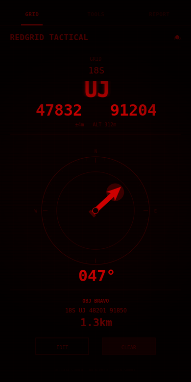
4/6/8/10-digit precision. 1-meter resolution. Tap to copy any grid to clipboard.
WMM 2025 model (same as DoD). Auto-calculate or manual offset.
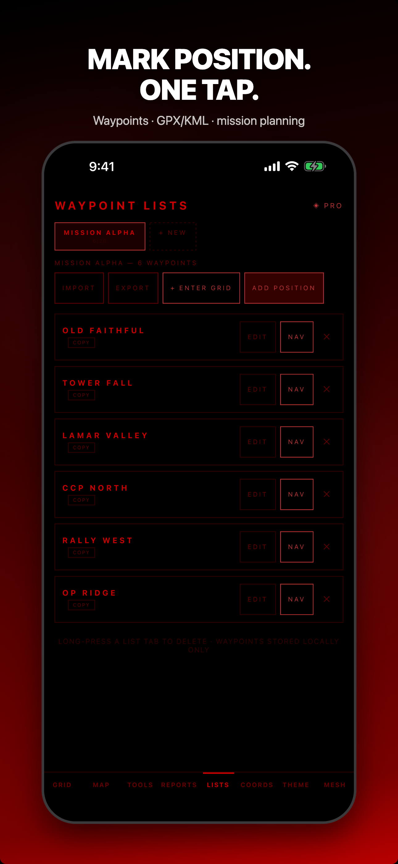
Save positions. Get bearing, distance, and a compass-relative arrow to any waypoint.
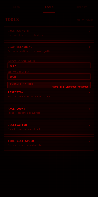
Back azimuth, dead reckoning, resection, pace count, TDS, sun/moon, precision selector, elevation/slope, photo geostamp, and more.
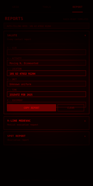
SALUTE, 9-Line MEDEVAC, SPOT, CASEVAC, ICS 201, CFF. Fill and copy, radio-ready.
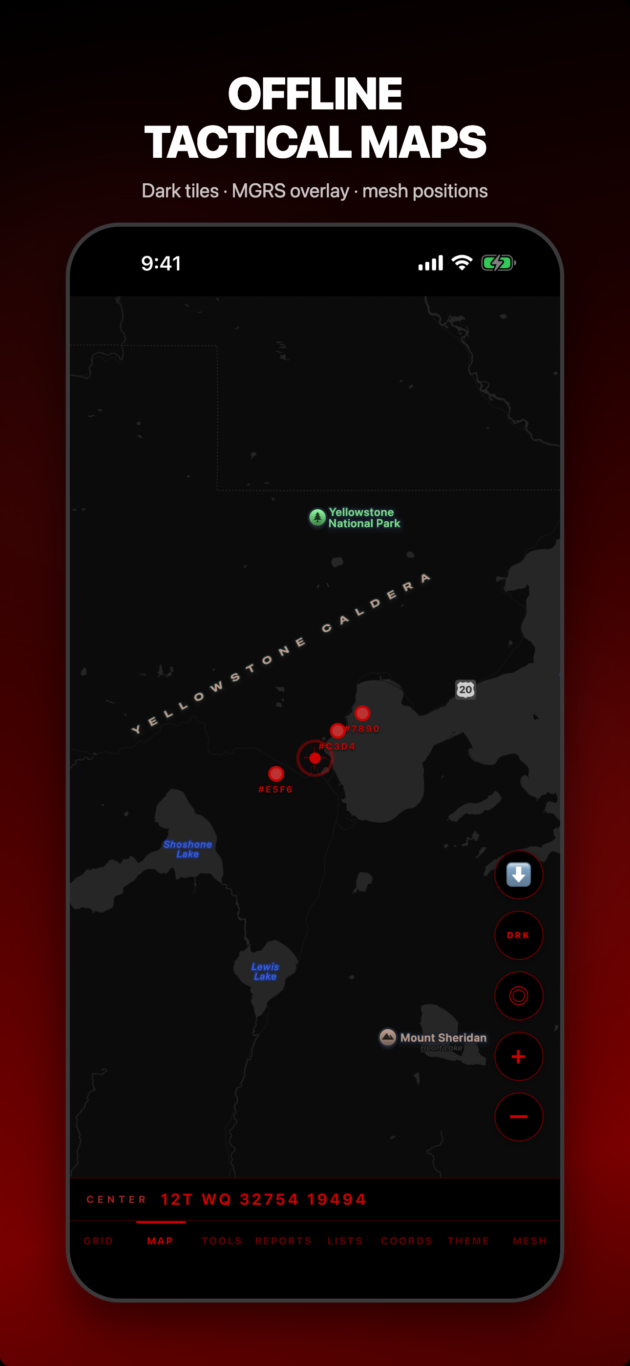
Download tiles for your AO. Standard, dark tactical, and topographic styles with contour lines. Works fully offline.
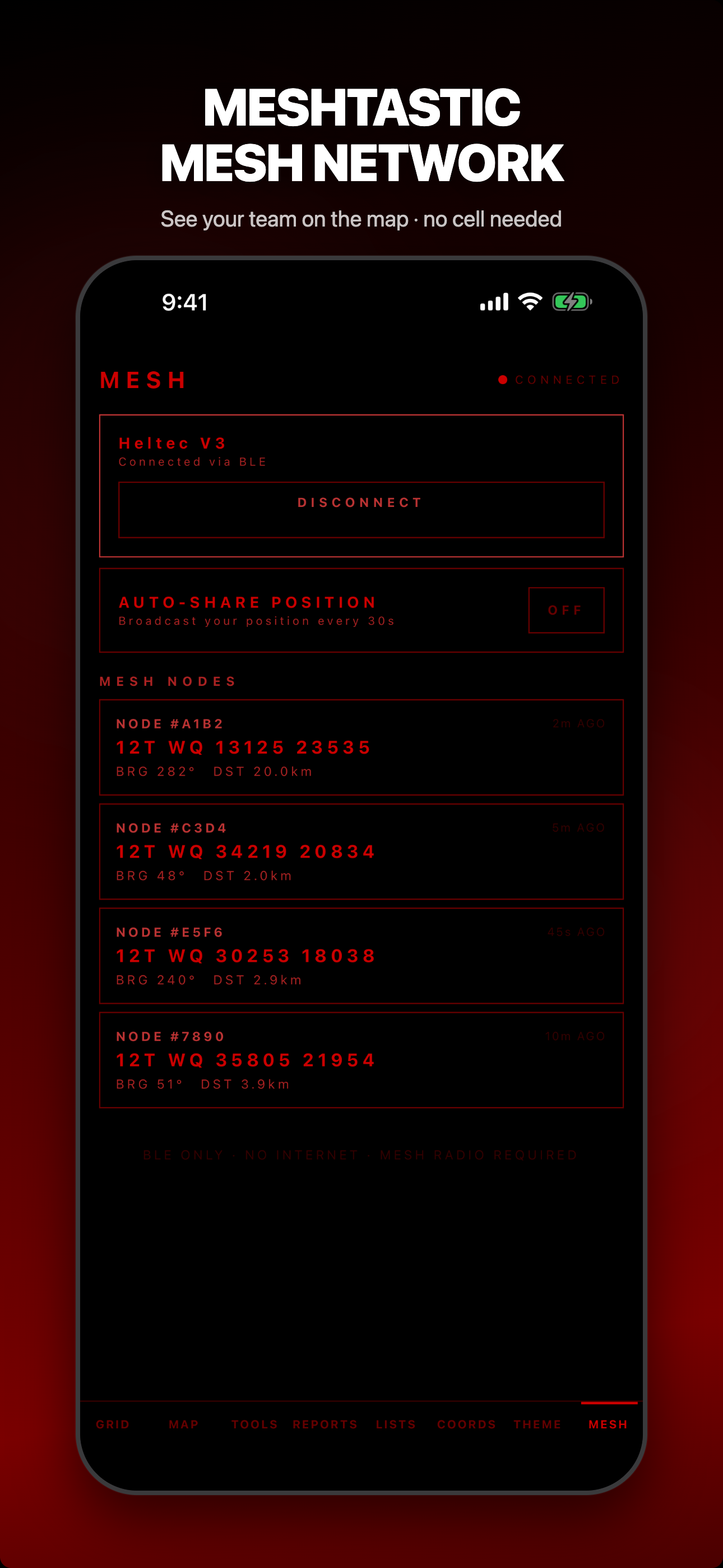
Share your grid over Meshtastic LoRa mesh via Bluetooth. See other users' coordinates, bearing, and distance. No cell service needed.
Photo geostamp, NATO voice readout, external GPS receivers, mission planning with GPX/KML, grid-crossing alerts, FixPhrase location codes, and full localization in 16 languages.
| Feature | Red Grid MGRS | DAGR (AN/PSN-13) | Tactical NAV | MilGPS |
|---|---|---|---|---|
| Price | Free | $2,500 | $4.99+ | $4.99 |
| Live MGRS | ✓ | ✓ | ✓ | ✓ |
| Magnetic Declination | ✓ WMM 2025 | ✓ | ✓ | ✗ |
| Report Templates | ✓ 6 types | ✗ | ✗ | ✗ |
| Source available: read every line | ✓ | ✗ | ✗ | ✗ |
| Zero Network / Tracking | ✓ Verified | ✓ | Unknown | Unknown |
| Tactical Tools | ✓ 10 tools | Limited | Some | Basic |
| Offline Maps | ✓ Tile download | ✗ | ✗ | ✗ |
| Mesh Networking | ✓ Meshtastic | ✗ | ✗ | ✗ |
| External GPS | ✓ BLE | ✗ | ✗ | ✗ |
| GPX/KML Import/Export | ✓ | ✗ | ✓ | ✗ |
| Mission Planning | ✓ | ✗ | ✗ | ✗ |
| Weighs | 0 lbs (your phone) | 1.0 lb | 0 lbs | 0 lbs |
Comparison as of June 2026, based on each product's public listings.
Red Grid MGRS makes zero HTTP requests during normal operation. Your position data exists in memory only.
Read: How the zero-network architecture works →Every release maps a single field workflow, not a feature grab-bag. Here's what just landed and what's next.
A one-tap READY / CAUTION / NOT READY check covering GPS, mesh radio, offline map coverage, permissions, and battery before you step off, plus saved AO map packages.
Drop waypoints, see leg distances and bearings, and let the app optimize the order. Import and export GPX/KML.
Connect a Bluetooth GPS receiver everywhere in the app, and broadcast your live position over Meshtastic mesh automatically.
Route cards and field export, deeper solo mesh awareness, and interoperability with TAK, CalTopo, and Avenza. All without accounts or tracking. Team features (shared sessions, messaging, roles) live in the separate Red Grid Link app.
For training, STXs, ruck marches, and permissive GPS environments: yes. The DAGR's SAASM module matters in contested environments, but for the other 90% of use, Red Grid MGRS delivers the same core land nav capabilities.
Yes. The app uses your phone's GPS receiver, which communicates directly with satellites. No cell tower, no Wi-Fi, no internet required. Works in airplane mode.
None. Red Grid MGRS embeds zero analytics, zero tracking, and zero crash-reporting SDKs. GPS coordinates exist in device memory only. Read the source code to verify.
MGRS is built on UTM but adds the grid zone and 100km square so you can call a position quickly over the radio. Red Grid MGRS shows both formats, plus decimal degrees and DMS, so you can copy a location in whatever your team uses. Try the free online MGRS/UTM converter in your browser.
It runs the same military-grade math the DAGR uses, so the grids and bearings you read are dead-on. In practice your position accuracy comes down to your phone's GPS chip and how many satellites it can see. Pair an external GPS receiver and you'll match dedicated handhelds.
The app is free to download. Pro unlock is available as $3.99/month, $29.99/year (best value), or $199.99 lifetime (one-time, own forever).
Meshtastic is open-source firmware for LoRa radios that creates off-grid mesh networks. Red Grid MGRS connects to a Meshtastic radio via Bluetooth LE to share your grid position with other mesh users. You need a Meshtastic-compatible radio (~$20-40) to use mesh features. Without one, all other features work normally.
Yes. Red Grid MGRS is live on Google Play as of April 2026. Same features, same zero-network architecture, same pricing. Android 7+ (API 24+): phones and tablets.